Flying from New York to Los Angeles requires precision navigation across 2,500+
miles. Pilots need to know their exact position, direction, and distance to
destination constantly.
Modern aircraft use multiple navigation systems working together to ensure
accurate, reliable flight guidance.
The History of Aviation Navigation
Navigation technology has evolved dramatically over the past century.
Early Aviation (1920s-1940s)
Pilots navigated using maps and visual landmarks. They flew low enough to see
the ground and followed roads, rivers, and railroad tracks.
Radio Navigation Era (1940s-1980s)
Ground-based radio transmitters called VORs provided position information. Pilots
tuned to specific radio frequencies to determine their position.
GPS Era (1990s-Present)
Satellite-based GPS (Global Positioning System) revolutionized navigation by
providing precise position anywhere on Earth.
Modern Aircraft Navigation Systems
Commercial aircraft today use multiple navigation systems simultaneously for
maximum safety and accuracy.
GPS (Global Positioning System)
How it works:
24+ satellites orbit Earth. Aircraft receiver picks up signals from multiple
satellites. Computer calculates position based on signal timing. Provides accurate
position within 10-20 meters. Works anywhere on Earth.
Advantages:
Very accurate. Global coverage. Real-time position. Always available.
Disadvantages:
Can lose signal in poor weather. Requires clear line of sight to satellites.
Vulnerable to signal jamming (rare).
Modern aircraft have multiple GPS receivers for redundancy. If one fails, others
continue providing navigation.
Inertial Navigation System (INS)
How it works:
Sensors measure aircraft acceleration. Computer integrates acceleration data.
Calculates position change over time. Works even without external signals.
Continuously updated with GPS data.
Advantages:
Works without external signals. Very reliable. Immune to interference. Doesn’t
require radio signals.
Disadvantages:
Becomes less accurate over time without updates. More complex system. Requires
initial position input.
INS is the backup system that keeps the aircraft on course if GPS fails.
VOR (VHF Omnidirectional Range)
How it works:
Ground-based radio transmitters. Aircraft tuner receives VOR signals. System
determines bearing from the station. Pilot can navigate toward/away from known
radio stations. Provides cross-checks on position.
Modern use:
Backup to GPS. Used in route planning. Provides position verification. Still
installed on all aircraft.
VOR is the oldest system still in use but remains reliable.
ILS (Instrument Landing System)
How it works:
Ground equipment provides precise guidance for landing. Localizer beam guides
aircraft horizontally (left-right). Glideslope beam guides aircraft vertically
(up-down). Aircraft instruments show exactly how to position plane for landing.
Allows landing in low visibility/fog conditions.
Advantages:
Enables landing in poor visibility. Extremely precise. Safe and reliable.
Required for bad weather operations.
This is the system that allows planes to land safely in dense fog.


Modern Flight Management Systems
The Flight Management Computer (FMC) is the brain of modern aircraft navigation.
Capabilities:
- Stores complete flight plan (waypoints, fixes, airways)
- Calculates optimal fuel routes
- Monitors position from multiple sources
- Updates navigation data from ground stations
- Guides autopilot through entire flight
- Provides real-time fuel and time calculations
- Predicts arrival time and fuel requirements
Integration:
FMC combines GPS, INS, and VOR data. Uses most accurate available information.
Automatically detects inconsistencies. Alerts pilot if signals disagree.
Continuously cross-checks position.
The FMC essentially flies the plane automatically using navigation guidance.
How Pilots Use Navigation Systems
Pre-Flight
Pilots input flight plan into FMC, including:
- Departure airport
- Destination airport
- Preferred altitude
- Specific route (airways, waypoints)
- Alternate airports
En Route
FMC guides autopilot following the planned route. Pilots monitor:
- Position on display
- Progress toward destination
- Fuel consumption
- Weather ahead
- Altitude and heading
- All navigation systems functioning
Approach
As destination approaches:
- Pilot contacts air traffic control
- Receives approach clearance
- Follows radar vectors (directions) from controller
- Receives ILS guidance for final approach
- Transitions to visual landing
Landing
Using ILS guidance or visual cues:
- Pilots align aircraft with runway
- Descend to runway
- Touch down at designated position
- Apply reverse thrust and brakes
- Taxi to gate
Backup Systems and Redundancy
Commercial aircraft have multiple backup systems ensuring navigation never fails.
Navigation Redundancy:
- Primary navigation: GPS + INS + VOR
- If GPS fails: INS + VOR continue
- If INS fails: GPS + VOR continue
- If VOR fails: GPS + INS continue
No single system failure can render aircraft without navigation.
Landing System Redundancy:
- Primary approach: ILS
- Backup: Radar guidance from air traffic control
- Final option: Visual approach in good weather
Pilots are trained to navigate using any combination of available systems.
The Accuracy and Safety
Modern navigation allows several important capabilities:
Route Following – Planes follow narrow air corridors with GPS accuracy
better than 10 meters. Aircraft stay on planned routes predictably.
Position Accuracy – Position known to within 10-30 meters at any time. This
allows precise fuel planning and timing.
Arrival Prediction – Systems predict arrival time within seconds accuracy
over 5-hour flights.
Collision Avoidance – Knowing exact position of every aircraft allows air
traffic control to maintain safe separation.
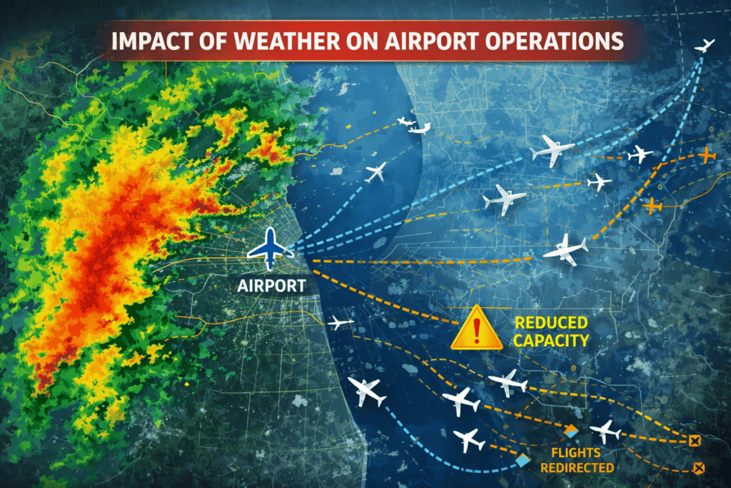
Weather Avoidance – Pilots see exact weather positions and can navigate
around storms precisely.
The Future of Navigation
Modern aviation navigation is transitioning toward even better systems.
NextGen GPS – Improved GPS with better accuracy and reliability. Current
systems are being upgraded.
RNP Navigation – Required Navigation Performance allows aircraft to follow
precise curved approaches, improving efficiency.
Autonomous Navigation – Future aircraft may navigate and land autonomously
using advanced systems.
For those interested in airport management careers, see our guides on airport operations fundamentals, airport duty manager responsibilities, and airport careers.
Conclusion
Aircraft navigation has evolved from following railroad tracks to GPS-guided
routes through crowded airways.
Modern aircraft use multiple redundant systems ensuring navigation is safe,
accurate, and reliable.
The next time you’re on a flight, remember that your pilot isn’t manually
steering toward the destination.
Advanced navigation systems are guiding the flight with remarkable precision.
It’s one of aviation’s greatest achievements.